


Beware. The sky is falling.
Posted by scissortailed , Tuesday, May 11, 2010 6:21 PM
When the Storm Prediction Center here in Norman issued a Particularly Dangerous Situation (PDS) Tornado Watch for most of Oklahoma May 10th, they weren't joking. Emergency managers are still assessing damage, while meteorologists weed through storm reports to better understand the outbreak and it's severity.
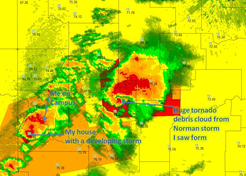
When the watch was issued, there were very few storms in the Oklahoma/Kansas area. Those that formed, developed fast and roared E to NE at speeds of 50+ mph. Vortex 2 parked near Perry, OK early to decide where to go.
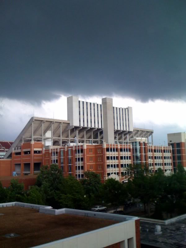
Picture from George Davis from the fourth floor of Richards Hall looking towards the OU Stadium.
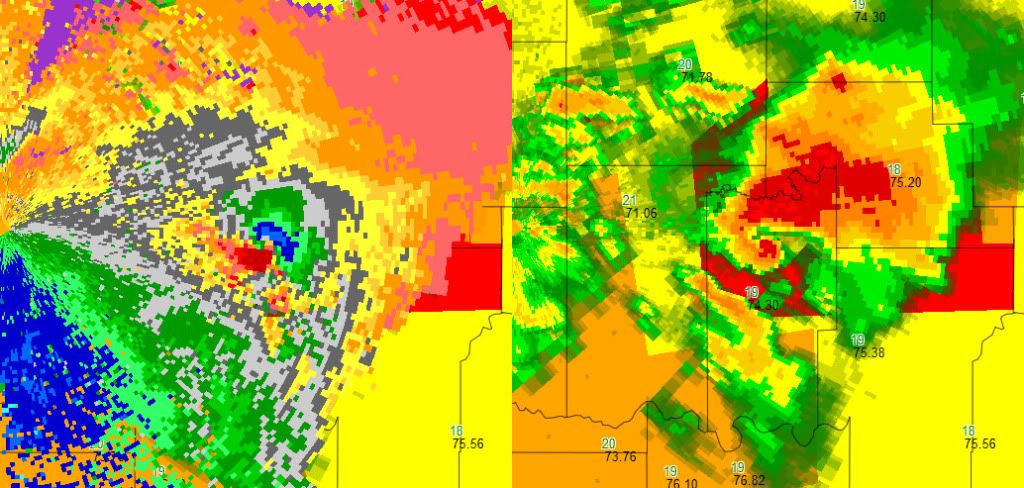
On the right you can see the velocity associated with this storm, with reflectivity shown on the right. On the velocity image, red indicates wind moving away from the radar, while blue indicates wind moving towards the radar. The blue/red signature shown is a Tornado Vortex Signature (TVS).
A second storm formed in the wake of the Cleveland County storm (shown in the labeled image). Again, had the dryline been further west, my house (30 minutes south of campus) may have been hit by that second storm Instead, the southern storm hit east of me in Purcell proper (the city I live outside of) and continued east to hit Tecumseh pretty hard.
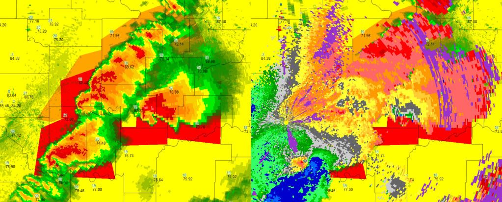
This image depicts the storm that went through Moore/OKC, the Norman storm, and the storm leaving Purcell. This time velocities are shown on the right, with the storm initially from Norman still producing a large tornado.
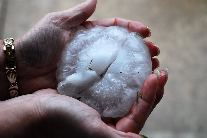
Large hail that fell in Moore, Oklahoma (courtesy of George Davis and Teresa Jones Davis).
Posted in
Post a Comment